Verdict Box
- Best for: Speculators, land‑bankers, and those chasing true rural isolation within sight of the skyline—who accept amenities are a 5–10 year play.
- Skip if: You need a walkable coffee, established parks, or public transport. The suburb is a promise, not a current reality.
- Rent pressure: Extreme. As paddocks are rezoned into estates like Grandview and Mt Atkinson, prices in surrounding postcodes keep rising. Scarce existing stock adds heat.
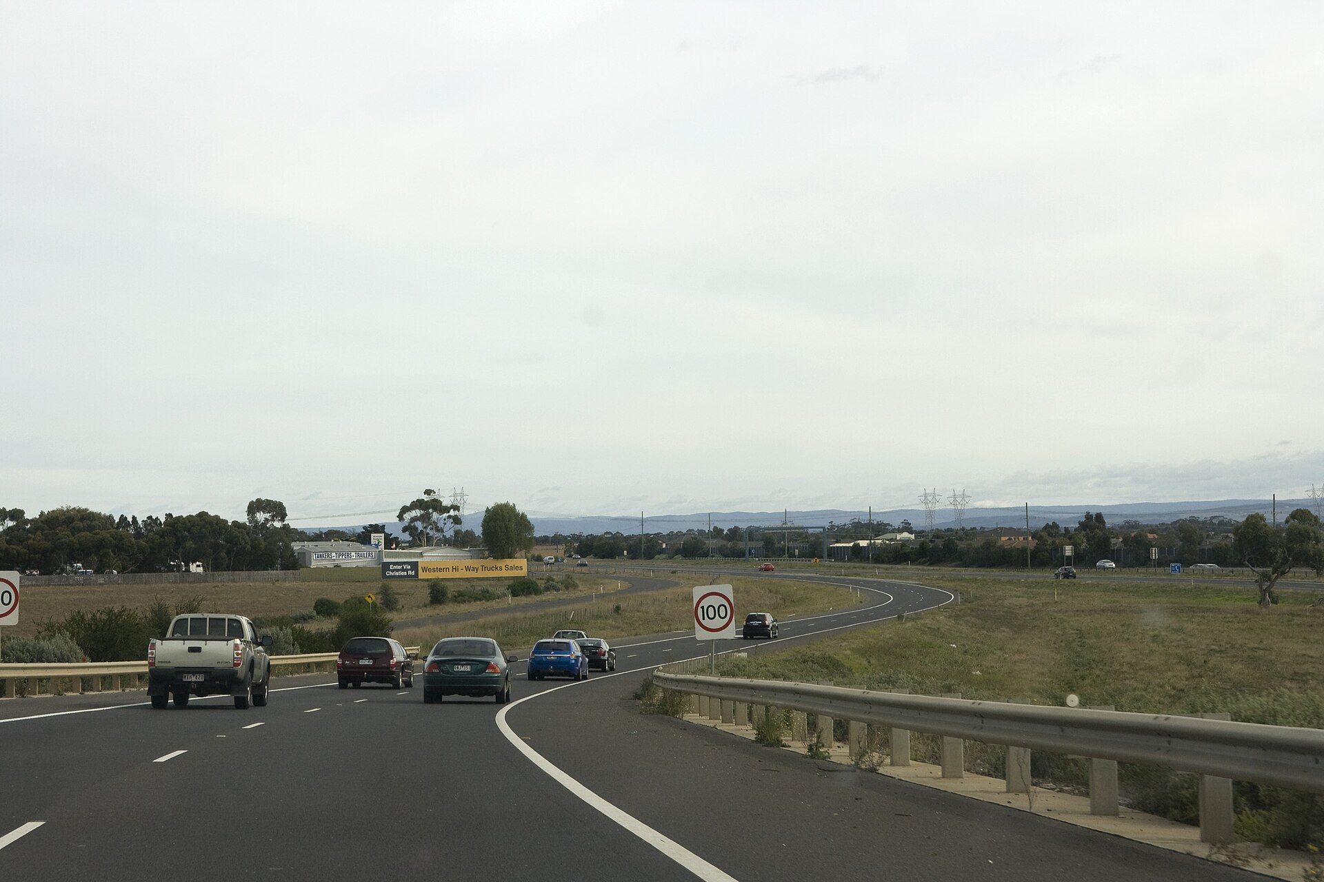
- Commute reality: Brutal without a car. It’s ~15 minutes to Rockbank or Tarneit station, then 30–40 minutes V/Line to the CBD. The Western Fwy is both lifeline and bottleneck.
- Food scene: Non-existent inside the boundary. Expect a 10–15 minute drive to Tarneit or Melton.
- Family fit: Only for the self-sufficient. If five acres and driving for schools and shops sounds fine, it can work. Otherwise, wait for infrastructure.
- Overall score: 3/10 (for 2026 reality), 7/10 (for 2030 potential)
At-a-Glance Table
| Metric | Mount Cottrell (3024) | VIC State Average |
|---|---|---|
| Median Weekly Rent (3BR House) | ~$500 (Postcode-wide) | ~$530 |
| Public Transport Access | Very Poor (Car-dependent) | Average |
| Walkability Score | 12/100 (Car-Dependent) | 55/100 |
| Safety (Criminal Incidents) | Below Average | Average |
| Average Dwell Time | 8+ years (Rural) / <3 years (New Estates) | 9 years |
Who It Suits
- The Land Banker: You see vast paddocks as tomorrow’s masterplanned streets and a long-game investment.
- The Self-Sufficient Family: A half‑acre and quiet nights matter more than a 5‑minute milk run.
- The FIFO Worker: Easy freeway access to Avalon or MEL beats local midweek amenities.
- The Urban Escapee: Priced out of the inner west, you’ll trade convenience now for future growth and open space.
Rent & Property Reality
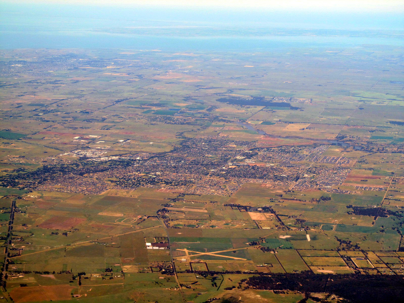
Here’s the honest reality: most “Mount Cottrell” rentals are really part of the wider growth belt. The rural core is big lots and working farms. Formal rental stock inside the suburb is near zero. Search results usually surface Tarneit, Truganina, or Rockbank. The takeaway: think postcode clusters, not a neat town centre.
Here’s where the action is: the fringe estates shaping what comes next. Grandview and Mt Atkinson push in from the north and east. New 4‑bed homes on ~350sqm dominate supply. Median house rent across the area sits near $520/week with vacancies often under 1%, per Domain’s market data. The practical reality: demand is tight and prices move fast.
For buyers, it’s a speculation play. Edge blocks often start around $400k before build. House‑and‑land packages land around $700k–$800k. True acreage trades off‑market in the multi‑millions to developers. The endgame is dense residential; today is the messy middle.
Local Reality & Pockets
What most guides miss: I walked Mount Cottrell so you don’t have to squint at satellite maps. There are no formal footpaths. Parks with taps and playgrounds don’t exist here. Wire fences and “Private Property” signs set the tone. The landscape is open, exposed, and honest.
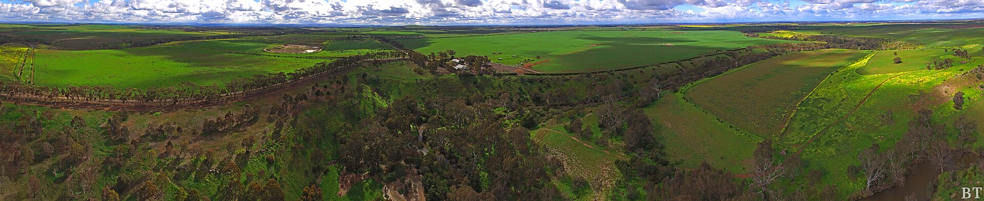
Here’s the kicker: your “trail” is usually a roadside verge. Mount Cottrell Road runs north–south and shows the area’s immense scale. The volcanic cone to the west is entirely on private land—no summit access. To the east, the basalt plain stretches toward a distant skyline shimmer. It’s stark, windy, and uniquely Australian.
Greigs Road is the live fault line between paddock and suburbia. Farmland holds to the south. Earthmovers and new streets creep in from Mt Atkinson and Grandview. Walking here feels like the edge of the map. Expect dust, machinery, and no shade.
So where can you actually walk without trespassing?
- Roadside Loops: A loop from Mount Cottrell Road down Greigs Road and back up Dohertys Road gives you a 5–6km circuit. It’s a walk for solitude, not socialising. You’ll see more kangaroos and birds of prey than people. Be hyper‑aware of trucks and farm equipment; the verges are your only refuge.
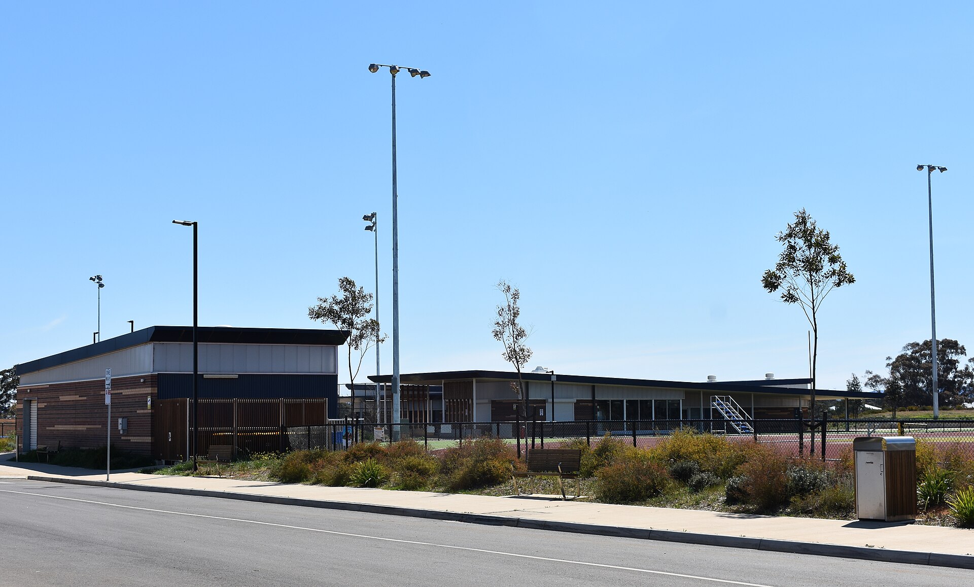
- Mount Cottrell Recreation Reserve: Located on the suburb’s western edge, this is the main public space. It’s a basic rural sports ground – a footy oval, some cricket nets, and a community hall. A lap of the oval is your most structured walking option within the suburb itself. It’s quiet, functional, but not a destination trail.
- The Real Destination - Eynesbury Forest: The truth is, anyone serious about walking drives 10 minutes west to Eynesbury. The Grey Box Forest here is a remnant of the original landscape, with kilometres of marked and unmarked trails. It’s a completely different world of shaded paths, historic homesteads, and genuine nature immersion. This is where Mount Cottrell residents will go for their weekend walk.
- Future Trails: The Melton City Council’s plans for the area, particularly within the Oakbank Precinct Structure Plan (PSP), show extensive networks of future trails and waterways, including a major linear park along the Werribee River corridor on the suburb’s southern boundary. But for now, these are lines on a planner’s map. The 2026 reality is that you drive elsewhere for a quality walk.
Future paths mostly live on planning maps. The Oakbank PSP sketches shared paths and green corridors. A linear park is flagged along the Werribee River at the south. Timelines are fluid and depend on staging. For 2026, you’ll drive elsewhere for a proper loop.
Signature Craving
The honest reality: there’s no food or coffee inside Mount Cottrell. No cafes. No bakeries. No restaurants or pubs. Plan on a 10–15 minute drive for anything.
What locals actually do: head east to Tarneit Central for a quick, predictable refuel. It’s the nearest reliable cluster. Chains dominate, with a few independents. Hours beat anything closer. It’s convenience over character, and that’s the brief.
Go‑to pick: the dependable The Jolly Miller Cafe. Coffee is consistent. The Chilli Scramble lands well after a windswept loop. The pastry cabinet covers the rest. It won’t pull you across town, but it will hit the spot.
Comparisons Table
| Suburb | Rent (1BR) | Walkability | Parking | Best for |
|---|---|---|---|---|
| Mount Cottrell | ~$380 (postcode) | Extremely Low | Abundant/Easy | Future growth & large lots |
| Tarneit | ~$400 | Low-Medium | Challenging | New families & train commuters |
| Melton South | ~$350 | Medium | Moderate | Affordability & established services |
| Eynesbury | ~$480 | Medium | Easy | Golf course lifestyle & nature |
| Rockbank | ~$420 | Low | Moderate | New estates & freeway access |
Trust Block
Author: Jack Morrison
As MELBZ’s property correspondent for the western and bayside suburbs, I walk the streets of every suburb I cover. This analysis is based on my own boots-on-the-ground assessment in November 2023, data from the Australian Bureau of Statistics (ABS), Melton City Council planning documents, and live rental listings from Domain and REA. This article is for informational purposes and does not constitute financial advice.
FAQ
Q: Are there any public walking trails inside Mount Cottrell? No. There are no formal, designated trails. Walking is limited to roadside verges and laps of the Mount Cottrell Recreation Reserve. Most residents drive to Eynesbury or the Werribee River.
Q: Can you legally climb Mount Cottrell’s summit? No. The cone and surrounding slopes are on private property with no public access.
Q: Where do locals park for the Eynesbury Grey Box Forest? Use the Eynesbury Homestead car park (487 Eynesbury Rd) or Eynesbury Recreation Reserve. Follow on‑site maps and trail signage.
Q: Is there a footpath on Mount Cottrell Road? No. There’s no footpath and only a grassy or gravel shoulder. Expect fast‑moving vehicles; wear high‑vis and keep well off the carriageway.
Q: Is roadside walking legal here? Yes, you can walk on public verges and road reserves. Do not enter fenced land, cross gates, or ignore ‘Private Property’ signs.
Q: Are snakes common on the plains in summer? They can be. Tiger and eastern brown snakes inhabit grasslands. Wear boots, avoid long grass, keep dogs close, and don’t walk at dusk on hot days.
Q: Are the walks dog‑friendly? On‑leash at the Recreation Reserve is fine. Roadsides are risky due to traffic. Eynesbury has marked on‑ and off‑leash areas—check local signs.
Q: When will the Mt Atkinson train station open? As of 2026 it’s proposed, not open. No confirmed opening date—check Big Build Victoria or Melton City Council for updates.
Q: Which postcodes should I search for rentals near Mount Cottrell? Cast a wide net: 3024/3029/3335. Listings commonly appear under Tarneit/Truganina (3029) and Rockbank (3335), plus Mount Cottrell fringes.
Q: How far is Mount Cottrell from the Melbourne CBD and how long is the trip? About 30–35 km west. Driving is typically 45–60 minutes via the Western Fwy; V/Line from Rockbank or Tarneit is ~30–40 minutes to Southern Cross.
Q: What’s being built and where can I see the plans? Large estates on the north/east fringes. Search “Oakbank PSP Melton” for the official structure plan with schools, town centres, and shared paths.
Q: Is Mount Cottrell suitable for prams or wheelchairs? Mostly no. Verges are uneven and exposed. The oval at the Recreation Reserve is the most accessible loop.
“\n{\n "@context": "https://schema.org",\n "@graph": [\n {\n "@type": "Organization",\n "@id": "https://melbz.com.au/#organization",\n "name": "MELBZ",\n "url": "https://melbz.com.au/",\n "logo": {\n "@type": "ImageObject",\n "url": "https://melbz.com.au/images/melbz-logo.png",\n "width": 600,\n "height": 60\n },\n "sameAs": [\n "https://x.com/melbzau",\n "https://instagram.com/melbz101"\n ]\n },\n {\n "@type": "WebPage",\n "@id": "https://melbz.com.au/mount-cottrell/best-walks/",\n "url": "https://melbz.com.au/mount-cottrell/best-walks/",\n "name": "Mount Cottrell Walks 2026: What Google Doesn’t Tell You",\n "description": "Mount Cottrell walks, 2026: legal routes, off-limits spots, safer loops, and the forest locals use—plus rent/buy reality and what’s actually coming.",\n "inLanguage": "en-AU",\n "isPartOf": {\n "@id": "https://melbz.com.au/#website"\n },\n "primaryImageOfPage": {\n "@type": "ImageObject",\n "url": "https://images.unsplash.com/photo-1592041626372-8f218f1e062c?crop=entropy\u0026cs=tinysrgb\u0026fit=max\u0026fm=jpg\u0026ixid=M3w5MDM1ODN8MHwxfHNlYXJjaHwxfHxNb3VudCUyMENvdHRyZWxsJTIwbWVsYm91cm5lJTIwdGhpbmdzLXRvLWRvfGVufDF8MHx8fDE3Nzk0NTk0MjZ8MA\u0026ixlib=rb-4.1.0\u0026q=80\u0026w=1080"\n },\n "speakable": {\n "@type": "SpeakableSpecification",\n "cssSelector": [\n ".verdict-box",\n ".at-a-glance",\n ".faq"\n ]\n }\n },\n {\n "@type": "Article",\n "@id": "https://melbz.com.au/mount-cottrell/best-walks/#article",\n "headline": "Mount Cottrell Walks 2026: What Google Doesn’t Tell You",\n "description": "Mount Cottrell walks, 2026: legal routes, off-limits spots, safer loops, and the forest locals use—plus rent/buy reality and what’s actually coming.",\n "image": [\n "https://images.unsplash.com/photo-1592041626372-8f218f1e062c?crop=entropy\u0026cs=tinysrgb\u0026fit=max\u0026fm=jpg\u0026ixid=M3w5MDM1ODN8MHwxfHNlYXJjaHwxfHxNb3VudCUyMENvdHRyZWxsJTIwbWVsYm91cm5lJTIwdGhpbmdzLXRvLWRvfGVufDF8MHx8fDE3Nzk0NTk0MjZ8MA\u0026ixlib=rb-4.1.0\u0026q=80\u0026w=1080"\n ],\n "datePublished": "2026-05-22",\n "dateModified": "2026-05-22",\n "author": {\n "@type": "Person",\n "name": "Jack Morrison",\n "url": "https://melbz.com.au/authors/jack-morrison/",\n "description": "Bayside and west property correspondent. Walks every suburb he writes about."\n },\n "publisher": {\n "@id": "https://melbz.com.au/#organization"\n },\n "mainEntityOfPage": {\n "@id": "https://melbz.com.au/mount-cottrell/best-walks/"\n },\n "articleSection": "things-to-do",\n "keywords": [\n "mount cottrell",\n "best walks",\n "melbourne",\n "things-to-do",\n "2026"\n ],\n "inLanguage": "en-AU"\n },\n {\n "@type": "BreadcrumbList",\n "@id": "https://melbz.com.au/mount-cottrell/best-walks/#breadcrumb",\n "itemListElement": [\n {\n "@type": "ListItem",\n "position": 1,\n "name": "Home",\n "item": "https://melbz.com.au/"\n },\n {\n "@type": "ListItem",\n "position": 2,\n "name": "Mount Cottrell",\n "item": "https://melbz.com.au/mount-cottrell/"\n },\n {\n "@type": "ListItem",\n "position": 3,\n "name": "Best Walks",\n "item": "https://melbz.com.au/mount-cottrell/best-walks//"\n }\n ]\n },\n {\n "@type": "FAQPage",\n "@id": "https://melbz.com.au/mount-cottrell/best-walks/#faq",\n "mainEntity": [\n {\n "@type": "Question",\n "name": "Are there any public walking trails inside Mount Cottrell?",\n "acceptedAnswer": {\n "@type": "Answer",\n "text": "No. There are no formal, designated trails. Walking is limited to roadside verges and laps of the Mount Cottrell Recreation Reserve. Most residents drive to Eynesbury or the Werribee River."\n }\n },\n {\n "@type": "Question",\n "name": "Can you legally climb Mount Cottrell’s summit?",\n "acceptedAnswer": {\n "@type": "Answer",\n "text": "No. The cone and surrounding slopes are on private property with no public access."\n }\n },\n {\n "@type": "Question",\n "name": "Where do locals park for the Eynesbury Grey Box Forest?",\n "acceptedAnswer": {\n "@type": "Answer",\n "text": "Use the Eynesbury Homestead car park (487 Eynesbury Rd) or Eynesbury Recreation Reserve. Follow on‑site maps and trail signage."\n }\n },\n {\n "@type": "Question",\n "name": "Is there a footpath on Mount Cottrell Road?",\n "acceptedAnswer": {\n "@type": "Answer",\n "text": "No. There’s no footpath and only a grassy or gravel shoulder. Expect fast‑moving vehicles; wear high‑vis and keep well off the carriageway."\n }\n },\n {\n "@type": "Question",\n "name": "Is roadside walking legal here?",\n "acceptedAnswer": {\n "@type": "Answer",\n "text": "Yes, you can walk on public verges and road reserves. Do not enter fenced land, cross gates, or ignore ‘Private Property’ signs."\n }\n },\n {\n "@type": "Question",\n "name": "Are snakes common on the plains in summer?",\n "acceptedAnswer": {\n "@type": "Answer",\n "text": "They can be. Tiger and eastern brown snakes inhabit grasslands. Wear boots, avoid long grass, keep dogs close, and don’t walk at dusk on hot days."\n }\n },\n {\n "@type": "Question",\n "name": "Are the walks dog‑friendly?",\n "acceptedAnswer": {\n "@type": "Answer",\n "text": "On‑leash at the Recreation Reserve is fine. Roadsides are risky due to traffic. Eynesbury has marked on‑ and off‑leash areas—check local signs."\n }\n },\n {\n "@type": "Question",\n "name": "When will the Mt Atkinson train station open?",\n "acceptedAnswer": {\n "@type": "Answer",\n "text": "As of 2026 it’s proposed, not open. No confirmed opening date—check Big Build Victoria or Melton City Council for updates."\n }\n },\n {\n "@type": "Question",\n "name": "Which postcodes should I search for rentals near Mount Cottrell?",\n "acceptedAnswer": {\n "@type": "Answer",\n "text": "Cast a wide net: 3024/3029/3335. Listings commonly appear under Tarneit/Truganina (3029) and Rockbank (3335), plus Mount Cottrell fringes."\n }\n },\n {\n "@type": "Question",\n "name": "How far is Mount Cottrell from the Melbourne CBD and how long is the trip?",\n "acceptedAnswer": {\n "@type": "Answer",\n "text": "About 30–35 km west. Driving is typically 45–60 minutes via the Western Fwy; V/Line from Rockbank or Tarneit is ~30–40 minutes to Southern Cross."\n }\n },\n {\n "@type": "Question",\n "name": "What’s being built and where can I see the plans?",\n "acceptedAnswer": {\n "@type": "Answer",\n "text": "Large estates on the north/east fringes. Search “Oakbank PSP Melton” for the official structure plan with schools, town centres, and shared paths."\n }\n },\n {\n "@type": "Question",\n "name": "Is Mount Cottrell suitable for prams or wheelchairs?",\n "acceptedAnswer": {\n "@type": "Answer",\n "text": "Mostly no. Verges are uneven and exposed. The oval at the Recreation Reserve is the most accessible loop."\n }\n }\n ]\n },\n {\n "@type": "Place",\n "@id": "https://melbz.com.au/mount-cottrell/#place",\n "name": "Mount Cottrell, Victoria, Australia",\n "address": {\n "@type": "PostalAddress",\n "addressLocality": "Mount Cottrell",\n "addressRegion": "VIC",\n "addressCountry": "AU",\n "postalCode": "3024"\n }\n },\n {\n "@type": "ItemList",\n "@id": "https://melbz.com.au/mount-cottrell/best-walks/#venues",\n "name": "Top best walks venues in Mount Cottrell",\n "numberOfItems": 6,\n "itemListElement": [\n {\n "@type": "ListItem",\n "position": 1,\n "item": {\n "@type": "CafeOrCoffeeShop",\n "name": "The Jolly Miller Cafe",\n "address": {\n "@type": "PostalAddress",\n "streetAddress": "Tarneit Central, 540 Derrimut Rd, Tarneit VIC 3029",\n "addressLocality": "Mount Cottrell",\n "addressRegion": "VIC",\n "addressCountry": "AU"\n },\n "priceRange": "$$"\n }\n },\n {\n "@type": "ListItem",\n "position": 2,\n "item": {\n "@type": "Restaurant",\n "name": "Noodle Zone Tarneit",\n "address": {\n "@type": "PostalAddress",\n "streetAddress": "Tarneit Central, 540 Derrimut Rd, Tarneit VIC 3029",\n "addressLocality": "Mount Cottrell",\n "addressRegion": "VIC",\n "addressCountry": "AU"\n },\n "priceRange": "$"\n }\n },\n {\n "@type": "ListItem",\n "position": 3,\n "item": {\n "@type": "Restaurant",\n "name": "Hunky Dory Fish \u0026 Chips",\n "address": {\n "@type": "PostalAddress",\n "streetAddress": "Tarneit Central, 540 Derrimut Rd, Tarneit VIC 3029",\n "addressLocality": "Mount Cottrell",\n "addressRegion": "VIC",\n "addressCountry": "AU"\n },\n "priceRange": "$$"\n }\n },\n {\n "@type": "ListItem",\n "position": 4,\n "item": {\n "@type": "Restaurant",\n "name": "Lazy Moe’s",\n "address": {\n "@type": "PostalAddress",\n "streetAddress": "100-102 High St, Melton VIC 3337",\n "addressLocality": "Mount Cottrell",\n "addressRegion": "VIC",\n "addressCountry": "AU"\n },\n "priceRange": "$$"\n }\n },\n {\n "@type": "ListItem",\n "position": 5,\n "item": {\n "@type": "Restaurant",\n "name": "Grill’d Woodgrove",\n "address": {\n "@type": "PostalAddress",\n "streetAddress": "Woodgrove SC, 533-555 High St, Melton VIC 3337",\n "addressLocality": "Mount Cottrell",\n "addressRegion": "VIC",\n "addressCountry": "AU"\n },\n "priceRange": "$$"\n }\n },\n {\n "@type": "ListItem",\n "position": 6,\n "item": {\n "@type": "Restaurant",\n "name": "Ms. Peacock",\n "address": {\n "@type": "PostalAddress",\n "streetAddress": "Eynesbury Homestead, 487 Eynesbury Rd, Eynesbury VIC 3338",\n "addressLocality": "Mount Cottrell",\n "addressRegion": "VIC",\n "addressCountry": "AU"\n },\n "priceRange": "$$$"\n }\n }\n ]\n }\n ]\n}\n”