You live in Richmond and want a walk that is actually good, not just technically nearby. Start with the Yarra from Burnley, use Citizens Park when time is tight, and save the full Capital City Trail for serious legs.
The Verdict
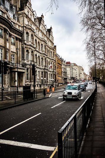
The best Richmond walk is the Burnley straight from Madden Grove to the Hawthorn bridge, especially if you want the cleanest mix of river, shade, distance, and zero road-crossing faff. It gives you 2.1km of flat path before you have to make a decision, which is rare in inner Melbourne. Keep going and you can turn it into a 7.4km dog-friendly loop via the south bank and north-of-river return, or fold back early and still feel like you got a proper reset. For runners, dog owners, pram-pushers, and anyone who wants Yarra access without getting in a car, this is the one to use first.
The obvious alternative is the Capital City Trail, and yes, it is useful: Richmond clips the 29km loop at multiple points, with bailouts near Richmond, East Richmond, and North Richmond stations. But for a normal weekday walk, the Burnley stretch beats it because it is calmer, flatter, and less stop-start. Citizens Park is the emergency option, not the winner: its 600m Coppin St perimeter loop is handy for parents, school-hour laps, and dogs within off-leash hours, but it will not scratch the same itch. Don’t make the North Richmond connector your main walk unless you are using it to reach Victoria St food afterwards; for river views, you will feel short-changed.
Local Reality
The Yarra trail through Richmond is not one continuous mood. The Cremorne wedge from Church St bridge to Punt Rd has the industrial-edge feel: converted warehouses, office workers spilling out for lunchtime runs, low foot traffic, and a bitumen path about 3m wide. It drains well after rain and works nicely for a 30-minute reset from Cremorne St gate to the Hawthorn footbridge and back, around 3.2km if you do not overthink it.
Burnley is the practical sweet spot. From Madden Grove toward Hawthorn bridge, cyclists use it hard, so pedestrians often drift to the gravel desire-line on the river side. Go early if you want quiet; by commute time the Capital City Trail energy takes over. Burnley Park gives you taps, open space, and dog off-leash windows from 5am-10am and after 4pm. Citizens Park on Coppin St is better for toddlers, change-table logistics, and short loops when the weather or nap schedule is against you.
The longer, moodier option is pushing past Hawthorn bridge toward Yarra Bend and Dights Falls, where Richmond starts to feel less like Richmond and the path narrows. You will get bush, kayakers, and the climb toward Yarra Boulevard, which is the only real gradient in the local network. Skip this if you need wide sealed paths the whole way. If you are west of Lennox St and mainly want dinner plus a stroll, use the North Richmond connector to Victoria St instead; if you want longer uninterrupted bush trails, go to Warrandyte or the Dandenongs.
Who This Suits
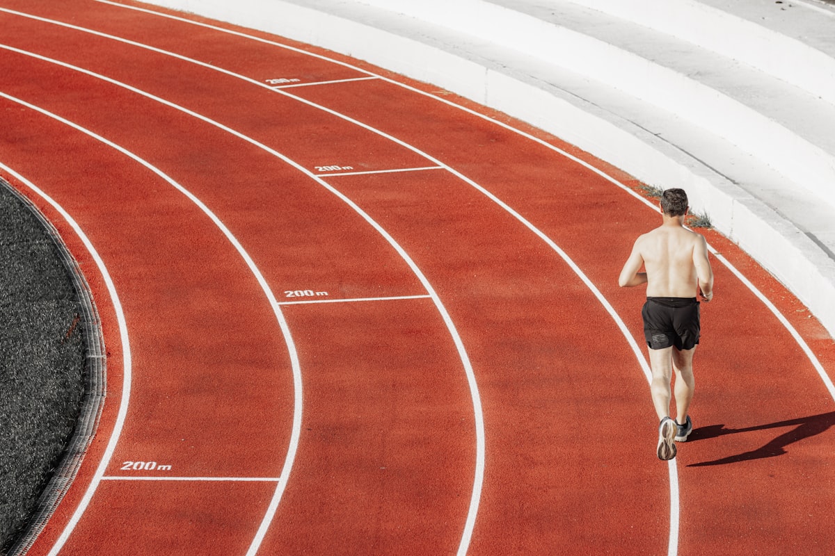
If you are a Cremorne tech worker, pick the Cremorne St gate to Hawthorn footbridge out-and-back. It is around 3.2km, mostly shaded, and realistic between a 9am stand-up and a 10am meeting. If you are a Burnley dog owner, pick Burnley Park to Hawthorn via the south bank and come back north of the river; the 7.4km loop, taps, off-leash windows, and Skinny Dog Hotel turnaround make it the most useful everyday route. If you are a pram-pushing parent, pick Gleadell Street to Yarra Bend playground, 1.8km each way, with sealed paths, benches, shade until about 11am on the north bank, and Citizens Park toilets nearby. If you are training properly, use Richmond as a Capital City Trail launchpad and take the 29km loop in chunks.
Cost-wise, Richmond makes more sense if you actually use the walks. Domain’s Q1 2026 Rent Report had median house rent around $780/week and units around $540/week, while the Yarra-adjacent streets such as Madden Grove, River St, and Williams Rd carry a rough 8-12% loading over the suburb median. Cremorne is steeper again, with house rents around $1,050/week in the CoreLogic June 2025 suburb scorecard. If morning walks are non-negotiable, that premium can beat driving to trails and paying for parking. If walks are only nice-to-have, Abbotsford or Collingwood gets you much of the same Yarra access for roughly $90-$110/week less.
Time of day matters. On a 32-degree day, use the shaded north-bank sections early and avoid exposed afternoon laps. Saturdays at 6.15am are runner-heavy around Burnley Park because local clubs such as Melbourne Marathon Crew and Richmond Harriers meet there. After school, Citizens Park gets busy fast. After 6.30pm, parking becomes easier on many nearby streets, but always read the City of Yarra signs because paid 2P blocks are common near trailheads.
What to Do Next
Walk the Burnley straight before 10am, then decide whether to turn back at Hawthorn bridge or keep going toward Yarra Bend. If you want the suburb decision behind the walk, read Living in Richmond.
Preserved Verdict Box
| Question | Answer |
|---|---|
| Best for | Runners, dog owners, parents with prams, anyone wanting Yarra access without a drive |
| Skip if | You need long uninterrupted bush trails — head to Warrandyte or the Dandenongs instead |
| Rent pressure | Median house rent ~$780/wk; unit ~$540/wk (Domain Q1 2026 data) — high but trail access is part of the package |
| Commute reality | Capital City Trail puts you in CBD in 18 min by bike; foot commute to Richmond station from any walk endpoint under 12 min |
| Food scene | Bridge Rd, Swan St and Victoria St all within 800m of the main trail entries |
| Family fit | Sealed paths, drinking fountains, playgrounds at Burnley Park and Citizens Park — pram and toddler friendly |
| Overall | 8.5/10 |
Preserved At-a-Glance Table
| Metric | Value | Source |
|---|---|---|
| Median house rent | $780/wk | Domain Rent Report Q1 2026 |
| Median unit rent | $540/wk | Domain Rent Report Q1 2026 |
| Walk Score | 92/100 | Walk Score (City of Yarra section) |
| Crime rate (CSA 2025) | 8,420 per 100k | Crime Statistics Agency Victoria |
| Nearest train | Richmond, East Richmond, North Richmond | PTV |
| Best loop distance | 2.4km–11km depending on route | Parks Victoria / Strava heatmap |
| Tree canopy cover | 19% (Yarra LGA avg) | City of Yarra Urban Forest Strategy |
| Parking near trailheads | Paid 2P most blocks, free after 6.30pm | City of Yarra signage |
Sources preserved from the original: Parks Victoria mapping, Bicycle Network’s Capital City Trail audit, City of Yarra open space strategy documents, Domain Rent Report Q1 2026, CoreLogic June 2025 suburb scorecard, Walk Score, Crime Statistics Agency Victoria, PTV, Strava heatmap, and City of Yarra signage.